Feeds:
Posts
Comments

Archive for June, 2009

Most interns expect to be the victim of some sort of initiation ritual, constant questions like “what’s your name” and “what are you doing here”, persistent condescending tones, or at least a first-week deluge of menial tasks.  So far, I’ve had nothing but exciting, educational adventures in the field; field researchers have been receptive and instructive; my daily assignments have rarely been bland. I feel happily exhausted and accomplished at the end of each day.  When I was told that I would be sent trudging through a deep stream in chest-high waders Monday afternoon, I began to wonder if this would be the dreaded assignment that would catapult me into the ranks of miserable interns – the gofers and guinea pigs of the working world.  Not so. I’m not sure if anyone else feels the same about their first experience wearing waders, but mine was filled with childlike glee.  Stepping into the water without getting wet was surreal.  I didn’t expect the pants of the overalls to suction to my leg, but it was a comforting pressure and made me feel much smaller and more graceful as my globular, waterproofed mass moved upstream.  Now that stooping in a stream in the homeliest of get-ups to clean rocks, pick leaf litter from a net, and jar bugs has failed to dim my spirit, I’m pretty certain that what boosts my enthusiasm for any field work day is more than dedication, work ethic, or complacency.  What stokes my zeal, no matter how wet or muddy I get or how far I trudge, is a genuine enchantment with the smallest wonders, like the tube of grit and rock chips hollowed out by a caddisfly making his home.  What motivates me to make the most of each opportunity is a heart-, soul-, and mind-burning interest in how science sorts intricate processes into simple steps for observation and analysis.
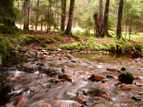
Stanley Brook S. Delheimer.

Stanley Brook © S. Delheimer.

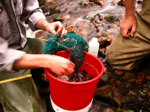
Monday afternoon, after suiting up, I traipsed (an awkward and physically challenging feat in thick overalls and rubber boots) down to the banks of Stanley Brook with John and Bik to check a small section for stream invertebrates. The procedure was surprisingly simple, so simple that my mentors agreed to let me take a crack at it.  I squatted down in the stream holding the specially crafted bucket just downstream of a mesh sack of rocks that were covered in leaf litter, grime, and hopefully a few bugs.  Without hesitation, I snatched the bag of rocks and dropped it into the pail.  A successful transfer.  I lugged the bucket over to our makeshift supply station along the water’s edge.  Holding the bag over the bucket, I opened the drawstring net and gave it a small shake, letting the rocks tumble back into the bucket.  The three of us set to work, wishing we had the nimble fingers of a pianist, plucking leaves and twigs and other litter off the net and placing it in the bucket with the rocks.  With the net picked clean, we moved on to the rocks, gently rubbing each one with one hand while rinsing it under a jet of water that the other hand pumped from a small water bottle and sent all the grit and grime back into the bucket. Clean rocks were placed back in the drawstring net and once full, the bag returned to its post in the stream.  The leaf litter was emptied into labeled mason jars.  As we stuffed the jars full, we looked for any signs of life – backswimmers, mayflies, caddisflies, and other aquatic invertebrates.  We found four insects in two sacks of rocks, but whoever is assigned the task of carefully sorting through all the leaves and dirt and twigs will likely find more.  Jars stuffed, we filled them 70% full with alcohol (to preserve the bugs for identification using a microscope and dichotomous key) and added just enough water to reach the neck of the jar.  Having emptied two of the three bags in our particular section of the stream and after concluding that there was no third bag to be found (perhaps a passerby thought it would make the perfect souvenir?), we called it a day and loaded the truck with our jars and stepped out of our wading gear.

StanleyBrook_20090629_SDelheimer (5)

StanleyBrook_20090629_SDelheimer (2)

The abundance and diversity of invertebrates in Acadia National Park’s streams is one indicator of stream health.  The community of life in a stream varies with its position along the length of the stream from rushing headwaters to flatter, slow-moving meanders.  A stream is a continuum of life.  Invertebrates are key components of the stream ecosystems and crucial links in many aquatic food chains.  Aquatic insects are an important part of the diets of many fish species.  Because populations of stream invertebrates shift with stream size and food production and fish follow the presence of their preferred insect food, researchers at Acadia NP question whether the migration of anadromous brook trout populations is affected by changes in stream invertebrate populations.  The stream invertebrate monitoring program seeks to answer such questions as: Does the number of stream invertebrates in Acadia NP’s streams provide a sufficient food supply for fish populations? What types of stream invertebrates are found in Acadia NP’s streams and what does this say about the quality of forage for fish?

Previous stream invertebrate monitoring projects looked only at communities around a single station, leaving gaps in the Park’s understanding of how stream invertebrate populations vary up and down the length of a stream.  Monitoring stream invertebrates with nets at a number of sites along the length of a stream will provide much needed baseline information and will allow researchers to analyze trends in stream health.

Read Full Post »

When I set out to hike the Anvil Trail around noontime, the landscape was still suffused with an oppressive grey pallor. The initial leg of the trek was familiar: I followed the loop road, walking against the steadily increasing flow of traffic, to the road entrance to the Schoodic Head trail. I’d been up that route before, and it was pretty much as I remembered: just enough of an incline to make me put deliberate effort into maintaining my pace. Up and up, around the wide winding bends until I reached the ledge steps that took me to Schoodic Head. Instead of following that trail to its end, I took the fork that led to Anvil.

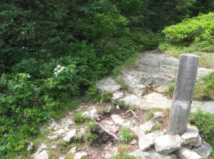
Natural steps in Anvil Trail

Natural steps in Anvil Trail

 When I walk a trail, I usually begin to lose touch with myself- not to say I go numb or retreat into my head- rather I sink into my footsteps and dissipate into the trees. If I didn’t talk to myself, I think I’d forget I was there!

Flowers clinging to the rock.

Flowers clinging to the rock.

Anvil Trail is for the most part narrow, and it twists and dips with the varying terrain. Some parts were steep, and it was all quite slippery with the remnants of last week’s pervasive damp. I kept to the soft needles and soil, avoiding the slick rocks as best I could, and hanging on to sturdy tree limbs when I needed to descend.

A smooth segment of Anvil Trail. I didn't take many photos of the slippery rocky bits because I needed both hands to steady myself!

A smooth segment of Anvil Trail. I didn't take many photos of the slippery rocky bits because I needed both hands to steady myself!

 My balance is nothing remarkable, and on wet rocks I wouldn’t even call it adequate, so this hike perhaps took me longer than it usually would to walk that distance, but it had been quite awhile since I had been so engulfed by woods, and it took me back many a year to my daily hikes in a neighbor’s forest.

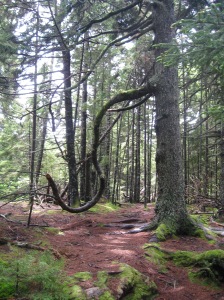
This tree reminded me of the essence of a question mark.

This tree reminded me of the essence of a question mark.

 I can’t imagine a forest that doesn’t smell like the woods in Maine. In fact I’d never really considered that there was any other way for a forest to smell until Sara and I discussed that very topic the other day. Wet loam and fresh needles and soaked bark released a pungent scent that sat heavy in the atmosphere, but it was a comforting weight.

View from a break in the trees.

View from a break in the trees.


The trees at the top of Maine hills always remind me of driftwood. They are stunted and wild like archaic forests.

The trees at the top of Maine hills always remind me of driftwood. They are stunted and wild like archaic forests.

 My encounters with other humans were scarce- I think I saw two pairs following the trail today, but I was not perturbed by the solitude. I said hello to the spiders I encountered and that suited my need for company just fine.

Spiderwebs in a crevice.

Spiderwebs in a crevice.

 The trail passed by swiftly, and when I emerged at the other end I was startled to be drenched in hazy sunlight. What a gift after a solid week (at least) of drear and clouds! And to my surpise I had emerged quite close to the entrance to my usual path, Alder Trail (across from Blueberry Hill). It was a short walk back to campus and I arrived back at the apartment much lighter of spirit than I  had been a mere hour and a half before. I always underestimate the value of time spent in the woods. I think maybe I forget so that when I return the joy and comfort are fresh and brilliant in my mind. So I will give Anvil Trail a little time to become a mystery to me again, and then I will go back, to disappear in the woods once more.

The end of the trail. Or the beginning, depending on where you start!

The end of the trail. Or the beginning, depending on where you start!

Read Full Post »

When the United States was first ‘discovered’ by Europeans so many years ago, those first explorers did not arrive in a land devoid of human life. North America was already well settled from coast to coast and Maine was no exception. Native American tribes were already firmly established within what are now the boundaries of the Pine Tree State.

There are four tribes remaining in the state of Maine, a far cry from the 20 or so that dwelt here in the 1500’s. They are the Penobscot, the Passamaquoddy, the Micmac (Mi’kmaq) and the Maliseet. I grew up in Bangor, which is right on the Penobscot river in Penobscot County, so I was somewhat familiar with that tribe. And I have certainly seen the Wabanaki license plates here and there throughout the area. But how was it that I was so very ignorant of the history of Maine’s native people? The keynote speaker at the Interpwoods workshops at College of the Atlantic went a long way towards amending that gap in my awareness.

                The speaker was Donald Soctomah, the tribal historian of the Passamaquoddy tribe as well as a representative to the Maine legislature. He was soft spoken but very deliberate, and as his words revealed how deeply he was steeped in the traditions and history of his people, his New England Patriots cap also hinted at his comfort with the realities of the modern world. Indeed, the tribes themselves are taking strides to align the information they wish to present with today’s technological sensibilities. As a supplement to his speech, Soctomah also guided the crowd through a multimedia presentation that presented the tribal names for many sites in Maine, including those on Mount Desert Island. Native American place names often described the site it referenced; for instance name Penobscot comes from panawahpskek, “the place of the white rocks,” or “where the rocks widen.” Tribe names were similarly derived; Passamaquoddy comes from pestomuhkatiyik, meaning “people of the pollock-spearing place.” According to Soctomah tribal names that we know today were often given by other tribes. He gave the example of the Maliseet, which is a Micmac word for “slow talker.” It was particularly interesting to me to hear the traditional place names in the presentation pronounced by a recorded tribal elder. Wabanaki is a particularly important word. It refers to the confederacy of tribes of the Northeast. All four of Maine’s tribes fall under the umbrella term Wabanaki, which means “People of the Dawn,” since they are the first of the tribes to see the dawn’s light rising in the east.

                The remaining members of Maine’s tribes are in different locations throughout the state, but they are usually concentrated in tribal reservations or within 50 miles of said reservations. The Micmac are located in Aroostook county in the far north of Maine, as are the Maliseet. The main reservation of the Penobscots is at Indian Island, in the Penobscot River near Old Town. The Passamaquoddy, having the largest population of the Maine tribes, have two reservations: one at Pleasant Point and one at Indian Township (both within Washington county). Each tribe is very distinct, but they all fall under the largest native linguist group in North America- the Algonquian.

                Since Soctomah was a member of the Passamaquoddy tribe, much of his information pertained specifically to that tribe’s history. The Passamaquoddy were primarily a hunter-gatherer society, following the herds as they moved across the land. They did establish trade relationships with the tribes of southern Maine, which were more inclined to agriculture. And of course, there was their particular method of spearing pollock which gave them their name. Today means of employment are more complex than being a hunter. Many of the tribe members living on reservations work for their tribal government.

                Soctomah also incorporated a few native legends into his presentation. The one that stuck in my mind particularly was the explanation for the red rocks in a body of water near Blue Hill. The story is that Glooscap (a traditional Wabanaki hero whose name is also sometimes spelled Glooskap, Keloskape, Gluskabe, Gluskap, or Koluskap) battled an immense moose and in the process of this fight cast the animal’s intestines into the water, where they can still be seen today.

                Written resources of the past are scarce, since native tribal tradition places an emphasis on oral history, which is gradually ebbing away in the face of technology. But some are still fighting to make the history of the Wabanaki accessible to the public. There is a new volume entitled Asticou’s Island Domain: Wabanaki Peoples at Mount Desert Island 1500-2000 that is available for online download via the National Park Service. The downloadable volume can be found at www.nps.gov/acad/historyculture/ethnography.htm. According to Soctomah, it is “a valuable piece of work.”

            I still feel like I have glimpsed only a facet of Maine’s tribal culture, but hopefully I will be able to keep adding to my knowledge with research and also by attending the Annual Native American Festival on Saturday, July 11 at the College of the Atlantic campus. This is a free event that will showcase tribal traditions and crafts. Also I will not be leaving the Acadia area without a visit to the Abbe Museum, which showcases Wabanaki culture and artifacts. For more information on the Abbe Museum, visit www.abbemuseum.org.

Read Full Post »

Our primary site for marsh coring.

Our primary site for marsh coring.

I highly doubt that I will ever cease to be amazed by the innovations of science. That’s a very broad statement, I know, but it astonishes me that we as a species can look at one indicator and suddenly see a whole wealth of information. Like identifying constellations, we can look up and connect the individual dots that suddenly reveal a startling whole.

Marsh coring is an excellent example of startling avenues between two branches of science that always seemed very different to me: geology and climate. Now, I know that geology can help us track the history of the earth’s climate evolution, but I had no idea that geological methods could be applied to help us comprehend what is happening in this very point in time in terms of climate change.

It turns out that environments called Tidal Saline Wetlands (TWS), which encompass mangroves and salt marshes, are capable of storing atmospheric carbon. An environment that does this is known as a sink. TWS’s can give scientists a valuable picture of carbon sequestration because they release significantly less CH4 into the atmosphere than freshwater marshes. According to Dr. Benjamin Tanner’s research proposal for studying this effect at Schoodic Point, “TSW’s have the potential to provide a negative feedback in the climate system by storing additional carbon, provided the wetlands keep pace with rising sea levels.”

The world’s oceans are rising, mostly due to thermal expansion of the seas. If the rate of sea level rise does not top 4mm per year, Maine’s salt marshes should be able to keep abreast of this factor. However, measurements taken at Bar Harbor’s tide-gauge station show an increase of 3.8 mm annually since the mid 1980’s. Following the rise of the seas and the subsequent likely movement of salt marsh boundaries, the potential for carbon storage in these areas could quite possibly be affected.

One sunny morning last week, I went out in the field with Dr. Tanner and Lee Sorrell, the student assisting him with his research. It was a beautiful day- blue skies, bald eagle wheeling above, steady flow of tourist traffic in response to the weather, I suppose. The marsh grasses bent innocently before a light breeze, belying the gravity of the information concealed beneath them.

A marsh, I soon discovered, is not a unified stretch of grass, mud, and water. In the Northeast marshes are divided up into three segments: low marsh, high marsh, and higher high marsh. We needed to take samples from each zone to devise a comprehensive picture of carbon sequestration throughout the entirety of the marsh.

The process of marsh coring seems rather simple at first glance. A tool called a Dutch auger is employed to take samples. It is driven into the ground, and then the handle is twisted to extract the sample. The samples are then examined and described according to root matter, color, and irregularities in the soil. The soil is divided by a matter of centimeters and stored to be taken to a lab for analysis. Dr. Tanner’s proposal stipulates that “In the lab, the cores will be sub-sampled at 5cm intervals and soil carbon accumulation rates will be calculated as a product of the average soil accretion rate and average carbon density rate for each individual sample.” The idea is that once enough data has been gathered about the carbon accumulation rates, a more comprehensive picture of carbon storage potential in different marsh zones will be visible.

Dr. Ben Tanner and geology student Lee Sorrell taking marsh core samples.

Dr. Ben Tanner and geology student Lee Sorrell taking marsh core samples.

A lot of this was far and away beyond the complexity of any science I’d studied before, but Dr. Tanner’s explanations were clear and concise, and the more I learned about this process, the more I became absolutely fascinated by how much information we can derive from something as simple as a soil sample. In Dr. Tanner’s own words, here is just a brief snippet of one of the many things I learned that day:

“Organisms basically aren’t using oxygen as their electron acceptor anymore, organisms in the soil tend to break down the organic matter and they have to use other ions. In salt marshes you’ve got abundant sulfate and sea water, and the organisms can use the sulfate, which they reduce to hydrogen sulfite gas, that’s H2s, which is what gives you the rotten egg odor in the marsh. The problem in the freshwater marsh, unless there’s a source of sulfate (usually there’s not), it’s not getting the tidal exchange from the ocean, it’s not getting sulfate, so the organisms there can’t use sulfate as an electron acceptor and what they end up using commonly in that situation is CO2- methane. They emit methane, which is a more potent greenhouse gas than CO2, so if you’re trying to store carbon, or thinking about carbon sequestration and you’re emitting methane that’s not necessarily a good thing. Ideally what we’d like to do eventually is to measure the methane emissions directly. This time we’ve brought a probe, which will basically give us an idea if we measure what’s called EH, or oxidation reduction potential, it’ll give us an idea of whether we’ve got sulfate being reduced or whether we’ve got CO2 being reduced, so it’ll at least give us some measurement of what’s going on. In order to do that, the EH measurements where you are, and what you’re reducing is also PH dependent, so we have to measure the PH as well.”

I don’t claim to be highly science literate, but I definitely got a sense of what was going on through that explanation and similar ones throughout the day. What a research proposal or a scientific quote won’t tell you, however, is how much fun the process of marsh coring can be. Or at least that was my reaction to the day’s activities. I broke a sandal in the sucking mud and from then on tromped barefoot through the muck and marsh grass all day, steeping my skin in salt water, identifying marsh plants, finding a solitary moose track (how a moose manages to leave only one track in the soft marsh earth I still don’t know). Part of the analysis of the cores depended on color-coding from an official book of soil shades. Finally an aspect of science that appealed to my artistic sensibilities!

Lee observing and describing variations in the core sample (i.e. color, plant matter)

Lee observing and describing variations in the core sample (i.e. color, plant matter)

In short, I learned a lot, I laughed a lot, and I will be very intrigued to discover the results of Dr. Tanner’s study. It is very valuable knowledge for Acadia and the scientific community, but also for the world at large. In today’s climate-focused consciousness, having a concrete window to the status of climate change is as intriguing as it is imperative. Or so it seems to me.

Read Full Post »

In the News

Two Field Notes authors, Hannah and Sara, recently made headlines! Way to go you two!

Read Full Post »

Somesville, the oldest settlement on Mount Desert Island (established in 1761), is situated at the northern end of Somes Sound, an important entry point for anadromous (sea-run) fish making seasonal migrations to freshwater in the Somes Pond-Long Pond watershed.  Many of Somesville’s older citizens recount stories of the springs of their childhoods, during which the streams and lakes were so full of alewives that a man could walk from one bank to the other on the backs of the silvery-sided fish.  Now, 80 years later, locals count each alewife that passes through the watershed, tracking the progress of a population in dire straits due to dams, pollution, and overfishing during the last two centuries.

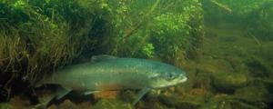
Alewives are members of the herring family with slender, silver-sided bodies growing up to 10 inches long (USFWS photo).

Alewives are members of the herring family with slender, silver-sided bodies growing up to 10 inches long (USFWS photo).

Alewives are anadromous fish, like salmon, that spend the majority of their life at sea, but return to freshwater to spawn.  Every May and June, guided by their sense of smell and temperature differences in the water, adult alewives migrate to the same streams and ponds in which they were born to reproduce.  A female alewife can produce 60,000 to 100,000 eggs each season, an evolutionary adaptation for overcoming high mortality rates for young fish. Unlike salmon, most alewives do not die after spawning, and instead make their way back to the ocean to wait for the next spring spawning season. Fertilized eggs mature quickly in warm freshwater streams and lakes, generally hatching within a month.  After hatching, young alewives spend two to six months in freshwater before migrating back to the sea, where they remain until they are sexually mature at three to four years of age.

Historically, more than 200,000 adult alewives followed streams from Somes Sound to Long Pond.  Native Americans, European settlers, and other fish and wildlife have depended on the bounty brought to inland waters by spring migrations.  Maine’s thriving alewife population plummeted during the last two centuries due to dams, pollution, and mismanagement of the fishery.  The dams, directly linked to Somesville’s industrial history and dating back to the late 1700s and early 1800s, once supported multiple mills. Alewives are not built to be agile swimmers, not strong jumpers and have difficulty passing over these barriers during upstream migration. Many fish are not strong enough to cut through the turbulent waters at the bottom of the barrier or cannot jump high enough to pass over the dam wall. These fish are left circling the waters below the dam, unable to reach spawning and nursery habitat. Even if some fish successfully traverse barriers on the upstream journey, the way back to the sea is just as challenging.  Approaching the edge of a 50-foot dam, some fish will jump off, landing on the jagged rocks below, cutting and bruising their bodies; others retreat to the pond, trapped in freshwater.

A large dam on Somes Sound is too tall for most alewives to jump over. A restored fish ladder (not visible) now runs along the side of the dam to aid anadromous fish passage S. Delheimer.

A large dam on Somes Sound is too tall for most alewives to jump over. A restored fish ladder (not visible) now runs along the side of the dam to aid anadromous fish passage © S. Delheimer.

Fish ladders were installed in the 1940s and 1950s, enabling alewives to negotiate past four mill dams in the Somes Pond- Long Pond watershed. A fish ladder, also known as a fishway, is a structure on or around barriers to facilitate anadromous fishes’ migration. Fish ladders enable fish to swim or leap up a series of low steps (hence the term “ladder”) into the waters on the other side. The velocity of water spilling over the steps must be great enough to attract the fish to the ladder, but not so great that it washes fish back downstream or exhausts them so that they cannot continue their journey upriver.  During the years directly following the installation of fishways, the alewife population boomed; however, the deterioration of these ladders has seriously degraded fish passage to the entire watershed and led to another precipitous drop in the alewife population.

The deterioration of the four fishways along the roughly one-mile stretch between Somes Sound and Long Pond has prevented tens of thousands of alewives from making their spawning run. Healthy alewife populations tie marine and freshwater ecosystems together, providing vital nutrients and forage needed to make healthy watersheds.  Many types of fish, birds, and mammals consume alewives as they are en route to and from their freshwater spawning grounds.  Both adult and juvenile alewives are small and are therefore eaten by many other species of native, introduced, commercially, and recreationally important fish.  The recovery of economically valuable fish depends, in part, on restored populations of alewives.  Birds like bald eagles, osprey, and herons, and mammals, such as otter, fox, and fisher, also prey on alewives. In addition, lobstermen use alewives as traditional spring bait for lobsters.

The Somesville Fish Passage Restoration Project, coordinated by David Lamon (executive director of the Somes-Meynell Wildlife Sanctuary) has taken on the task of restoring native anadromous (sea-run) fish populations, such as alewives, to historic spawning habitat in the Somes Pond and Long Pond watersheds within and adjacent to Acadia National Park.  The Park’s streams are blocked by numerous roads, dams, culverts, and other engineering features. Through the repair of several historic fish ladders in the Somesville area, access to over 1,000 acres of freshwater habitat has been restored.

The Somesville fish run begins as alewives migrate from the sea through Somes Sound (pictured above) S. Delheimer.

The Somesville fish run begins as alewives migrate from the sea through Somes Sound (pictured above) © S. Delheimer.

Alewives have hydrodynamic bodies that help them manuever through turbulent waters as the swim up Somes Brook S. Delheimer.

Alewives have hydrodynamic bodies that help them maneuver through turbulent waters as the swim up Somes Brook © S. Delheimer.

The multiphase project began five years ago with a census to determine the number of migrating alewives.  Although the run could support as many as 100,000 alewives, scientists documented only 360 migrating alewives in 2004, an indicator of poor ecosystem health.  In order to support the vitality of the watersheds, individuals and organizations on Mount Desert Island joined with state and federal agency biologists and engineers to restore the Somesville fish run, traditionally one of Maine’s largest.  Because of the historic nature of the area dams, the project planned to repair old fish ladders and supplement the alewife stock in Somes Pond, instead of removing the barriers.  The U.S. Fish and Wildlife Service (USFWS) Gulf of Maine Coastal Program and Region 5 Fish Passage engineers, Maine Department of Marine Resources biologists, NOAA’s Habitat Restoration Partnership biologists, and Gulf of Maine Council on the Marine Environment planners have provided vital funding and technical support.  The Maine Department of Marine Resources also augments the natural fishery population by stocking Somes Pond with adult alewives, whose spawn will return to the pond each spring.

The first phase of the fishway restoration project was completed in 2006.  At the first dam located near the entrance to Somes Sound, concrete walls and wooden baffles were repaired on a denil fish ladder built in the 1950s. A denil fish ladder consists of a concrete flume-like structure with a series of slotted boards across its length, which decrease the flow so that fish can swim from section to section without jumping.  At the top of the Somes Sound ladder a small gate forms a holding pond for alewives that have successfully traversed the ladder.  Twice per day during the spring migration season, researchers unlock the gate and count each alewife that swims through to the open pond.  After 3-4 weeks of spawning in freshwater, the adult alewives swim back down the run and exit through the same gate.

Denil fish ladder at the dam on Somes Sound S. Delheimer.

Denil fish ladder at the dam on Somes Sound S. Delheimer.

Few repairs were made to the pool and weir fish ladder (built in the 1940s) at the third dam, which originally diverted water to a woolen mill. Pool and weir fishways allow fish to swim up through a series of relatively low steps and jump from pool to pool. The original four pools were remortared and a metal rack was added to keep debris from damaging the ladder.

The third upstream fish ladder required few repairs. The metal debris rack was installed to prevent damage to the ladder caused by drifting logs and other debris

The third upstream fish ladder required few repairs. The metal debris rack was installed to prevent damage to the ladder caused by drifting logs and other debris © S. Delheimer.

The second phase focused on complex repair work at the second upstream fishway, a pool and weir ladder built in the 1940s by the Acadia NP division of the Civilian Conservation Corps, which did not allow fish to pass during low flow years. The restored ladder, consisting of a new concrete foundation and labyrinth of granite pools, was designed to complement the natural surroundings and was completed in 2008.

The restored pool and weir ladder was designed to use natural features and complement the scenic surroundings S. Delheimer

The restored pool and weir ladder was designed to use natural features and complement the scenic surroundings © S. Delheimer

The last phase of the project repaired the fishway at the outflow of Long Pond, where a dam is used to control the pond’s water level.  Wayside exhibits near the Somesville Historical Society Museum were installed to increase awareness, understanding, and support for the restoration project.

Observations over several years have shown that the number of alewives running upstream is increasing. Only one year after the project began, researchers tallied 2,000 fish; the migrating fish population increased to 4,500, 6,500, and nearly 14,000 in the following years. Although the number was expected to double again in 2008, only 14,000 alewives made the run, a number attributed to bad spring weather (alewives are sensitive to cold rainy days and will stop moving in these conditions).  The number of hatchlings heading downstream during fall migration is also on the rise, indicating that the fishery is being revitalized.  The overall increase in the number of migrating alewives is attributed to the fish passage restoration, stocking, and stewardship.

Although the number of alewives successfully navigating the run has been increasing since the restoration project began, these numbers are a tiny vestige of what the watershed used to support.  Restoring, monitoring, and maintaining fish passage in the Somes Pond-Long Pond watershed holds promise to bring back robust anadromous fish populations, which are central to a healthy web of life in Maine.  Volunteers and researchers will continue to monitor alewife populations (mostly with counts done at the Somes Sound gate) for the next several years to assess the effectiveness of the renovations and trends in anadromous fish populations.

Read Full Post »

Jenna Dodge’s weekly report on Acadia NP’s resident peregrine falcon family:

The two young at the Precipice have now fledged and are exploring their new-found ability by chasing the adults as best as possible and mimicking their swift movements. As I watch the Precipice falcon family, so vibrant and ever present on the rock face, it is hard to imagine that two decades ago there was absolutely no sign of peregrines soaring around the high cliffs on Mount Desert Island: the eastern subspecies (Falcus peregrinus anatum) had been extinct since the late 1950s. These magnificent birds, known for their especially large feet, met their demise due through the vast spraying of an infamous pesticide, DDT.

Peregrine falcon egg

Peregrine falcon egg (NPS photo).

Although highly efficient at killing insects and controlling the spread of disease, this contaminant infiltrated many ecosystems and accumulated throughout all trophic levels. Peregrine falcons are considered a keystone species because they are a top predator and indicate overall health of the environment. This means that due to a process called biomagnification, the amplification of a certain substance (i.e., contaminant) as it moves up a food chain, falcons were found to contain the highest concentrations of DDT and suffered most evidently from it. DDT prevented the deposit of calcium that is responsible for healthy egg production; instead of laying hard-shelled eggs, peregrines laid very thin and fragile ones that were vulnerable to shattering. Every time a female tried to incubate her clutch, her weight would smash the damaged eggs; this continued until the eastern U.S. literally ran out of peregrines.

Well, the world certainly took notice and action. In 1970, peregrine falcons were placed on the Endangered Species Act, and two years later DDT was banned in the United States. A decade later many reintroduction programs were implemented nationwide to restore this important bird on the East and West Coasts. Genes from various peregrine subspecies were used to create our falcons, which were raised in artificial nests, known as hack boxes, on cliff sides known to be historic peregrine breeding sites. In Acadia National Park, between 1984 and 1986, 22 peregrine eyases were released from Jordan Cliffs. This recovery scheme proved successful when one returned to the park. In 1991, thirty-five years after the last known peregrine pair was seen on Mount Desert Island, a male falcon returned to the Precipice Cliffs and attracted a mate. Every year since, there has been a pair nesting on these cliffs and, including the other three territories, 99 young have fledged in the park!

Thriving populations of peregrines in the West and most of the East led to their removal from the Endangered Species Act in 1999, yet they are still considered endangered in the state of Maine. It is important to understand that although DDT was banned in the U.S. many years ago, it takes a very long time to degrade; its prevalence in our environment means it continues to be a serious threat for peregrines. In 2007, a non-viable egg was collected from the Precipice scrape and tested for five categories of contaminants: mercury, PCBs, PBDEs, PFCs, and organ-pesticides. The results of this examination were extremely unexpected and opened many eyes, but you will have to stay tuned to find out more…

Please join us down at the Precipice trailhead 9 a.m. to noon daily (weather permitting) to catch a glimpse of our resident peregrine falcons. Keep in mind that the Precipice Trail, including a portion of the Champlain East Face Trail and the Valley Cove Trail (formerly the northern portion of the Flying Mountain Trail) are closed until mid-August to ensure the safety of the falcons and their young.

Read Full Post »

“Summer’s here”, the locals respond when I mention the wet weather.  More accustomed to southern summer droughts than monsoons, I do not know whether this statement implies that the wet, blustery weather is a fleeting signal of a change in the seasons, or whether it hints that the Maine rain will linger for the remainder of my ten week stay.  I do know that the extended forecast offers no signs of relief.

Even the simplest of activities become somewhat of a hassle in the rain.  Walking to work and taking laundry across the street are surprisingly saturating activities even with Gore-tex boots, a rain slicker, and a sprawling umbrella.  Grocery runs are more like painstaking crawls as I snake down Route 1 behind a long line of careful tourist navigators who are swerving wildly to avoid the filled-to-the-brim potholes and swift streams spilling across the road.  Making a phone call at Schoodic Point (this being the only place where I have a reliable one and a half bars of cell service) requires full rain gear and a trash bag to lay between the wet rocks and the seat of my jeans.

Yesterday was the summer solstice.  Summer’s here– cue the sun.  After a week of gray days of drizzle and dark nights of steamy fog, I am ready for the clouds to part and the sun to dry up my favorite jogging routes, hiking trails, and town blocks.  With rain in the forecast for another four days, I am preparing for a week holed up in the apartment or the office.  Although I am looking forward to a productive week (the allure of a sunny day is always such a distraction when trying to finalize resource briefs or get around to household chores), I will have to explore new indoor hobbies, as I am not content to spend all my free time checking the radar for a break in the clouds and scanning the extended forecast for a cheery cartoon sun.

Although it certainly provokes complaint, the rain has not totally dampened my spirits.  Recognizing this bout of inclement weather as a force of nature lifts some of the gloom.  Overflowing streams create powerful, episodic cascades and the turbulent surf, charged by the torrents and stormy gales, shoots ocean spray over the tops of the tallest rocks along the coast.  Islands disappear in misty shrouds.  An orchestra of birds and bugs joins a chorus of frogs on steamy nights.  Strong, warm winds send the trees into wild frenzies that cast eerie shadows on the aparment walls.  Little yellow flowers sprout in glistening fields.  Heavy and drooping under the water’s weight, trees unfurl new leaves in glowing, nearly translucent shades of green.  Sensing the signs that summer’s here, I don’t mind the rain quite so much.

Read Full Post »

We are in the midst of a rapid loss of biodiversity.  Over the past few hundred years species have been disappearing at a rate that is between 100 and 1,000 times the normal rate, and the pace has accelerated over the past 50 years.  (See the 2005 Millennium Ecosystem Assessment, Ecosystems and Human Well-being: Biodiversity Synthesis by the World Resources Institute, for supporting evidence and details.)  The principal drivers of biodiversity loss include changes in land cover (primarily habitat conversion to agricultural use), overexploitation, biotic homogenization, and climate change. In the May 25, 2009 issue of The New Yorker Elizabeth Kolbert published an excellent article titled “The Sixth Extinction?” in which she raises the question of whether we are living through the sixth massive, world-changing die off since the beginning of life on earth.  The last one wiped out the dinosaurs and opened up a new evolutionary opportunity for mammals and, eventually, humans.

The irony is that now, 65 million years later, it is human activity that is driving the next big extinction.

Part of our work at the Schoodic Education and Research Center focuses on supporting environmental science literacy.  The National Park Service’s mission is to “conserve the scenery and the natural and historic objects and the wild life therein and to provide for the enjoyment of the same in such manner and by such means as will leave them unimpaired for the enjoyment of future generations.”  With such a mission, awareness of accelerating mass extinction is clearly part of environmental science literacy.

With that in mind, consider an experiment.  Walk around your office or talk to your friends to do an informal survey.  Ask them whether they know that they are living through one of the largest mass extinctions to have happened over the past 500 million years.  I mean, if we are living through something that has only happened five other times in 500 million years, you might think people would know about it.

But, if they don’t know about it (and my bet would be that most won’t) ask them whether they believe you when you tell them it is so.   You might also ask them to rank the importance of mass extinction relative to, say, the Dow Jones Industrial Average, the price of oil, the situations in Iraq and Afghanistan, and … just for fun … the race between the Red Sox and the Yankees in the American League East.

My guess is that you will find the level of “extinction literacy” to be pretty low and the level of concern about it to be even lower. That presents us with a challenge: How do we make people aware of that we are losing species at an alarming rate and that it matters?

High school biology classes would seem to be one place to start.  But most high school biology teachers don’t spend much time on extinction; most texts provide only a brief mention of the issue — sometimes at the tail end of a thousand page book.

How can this be?  What’s the cause of this ignorance?  How do we fix it?

These are good questions and good topics for discussion among scientists and educators.  Possible answers include our insulation from the living world around us, difficulty in perceiving change over time, and lack of awareness about whatever diversity we have left.  I think that another answer is that the topic is really depressing.

I just finished another one of my science education essay/think pieces in which I argue that part of the way forward requires that we set aside the idea that extinction is the result of some kind of moral failure on the part of humans.  I ask whether we might be better off acknowledging that the extinction of other species is an inevitable consequence of what humans do to survive.  Once we get past the idea that we are somehow supposed to prevent extinction, can we think more clearly about how to ameliorate and manage it?  I would love to hear your thoughts — but, first, read the essay.

Read Full Post »

AMOy and WILL on Snake Island, 6.17.09, CLT.

AMOy and WILL on Snake Island, 6.17.09, CLT.


Well, we finally lucked out with the weather!  We had perfect conditions yesterday – calm, sunny, and increasingly warm as the morning progressed. 

We also had an early morning high tide that allowed us to start our day with a landing on Snake Island.  There were 4 Common Terns in the area and we saw a couple pass overhead carrying fish, but found no evidence of nesting.  We observed a total of 12 adult Willets (WILL), many of whom vehemently and vocally defended their turf as we made our way around the island (as only Willets do!) However, we did not come across any Willet nests or see any chicks in the area. 

We counted a total of 10 adult American Oystercatchers (AMOY) on the island, but most did not seem associated with territories.  At least one had a leg band, but we did not get close enough to read it.  Two pairs were actively defending and brooding chicks on the southwest outer beach.  After rounding the corner, we watched from a distance on shore as a Great Black-Backed Gull pulled a chick from the marsh and carried it out into the harbor to eat (see Bob’s photographic coverage of this sad event at: http://www.flickr.com/photos/rstymeist/sets/72157619827105289/).  The other pair’s two chicks also took to the water, swimming away from the island.  We were a good distance away, so I feel pretty confident that we were not the cause for alarm.  I had not previously seen chicks swim, but I did find the following reference for a similar species, Black Oystercatcher: ‘Behavioral Response To Predators: Young chicks respond to parental Alarm Calls by hiding under rocks, lying flat against substrate, or running short distances to cover. Chicks >25 d old occasionally swim and dive to escape predators; chicks can swim underwater, using wings, for short distances (Andres, Brad A. and Gary A. Falxa. 1995. Black Oystercatcher (Haematopus bachmani), The Birds of North America Online (A. Poole, Ed.). Ithaca: Cornell Lab of Ornithology; Retrieved from the Birds of North America Online: http://bna.birds.cornell.edu/bna/species/155)’

Other observations from Snake included a pair of Killdeer with one chick, 3 Mallards, one foraging Great Egret, one foraging Snowy Egret, and a Sharp-tailed Sparrow.

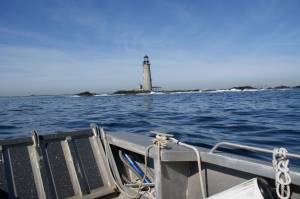
Graves Light from the landing craft, 6.18.09, CLT.

Graves Light from the landing craft, 6.17.09, CLT.

We continued our morning with a boat-based survey around all of the Outer Islands which resulted in a total count of 142 eider chicks attended by 162 females.  There were an additional 177 females without chicks and 93 juvenile males hanging about; only 11 adult males were observed.  Chick numbers are pretty similar to last week, and though we saw some larger/older chicks, there were also still quite a few young ones about.  Eider chick reports have started coming in from the mainland coast, so successful early broods have likely grown enough to manage the swim in for additional feeding opportunities.   

Four adult AMOY were circling and calling to one another from the air near the backside of Calf Island.  There was no sign of adults or chicks on the landing beach where we had seen them previously, but we did see a pair leaving the southeast beach on Calf a short time later.  Twice during our circuit a single, calling adult was seen flying around Middle Brewster, but we saw no sign of other adults or chicks on Middle Brewster or any of the other islands. Several Great Cormorants remain in the area. 

We finished our day with a stop on Lovells but there was no sign of Least Tern activity.  There were 2 pair of American Oystercatchers on the island, but they did not seem to be nesting, only feeding.  All in all, I’d have to say that it was a day of ups and downs – though we had great weather and good eider chick numbers, we witnessed a MURDER on Snake, saw many fewer successful oystercatchers than we would have liked, and found no nesting terns at all… 

But to end this post on a happier note, we did manage to find some satisfying treasure while walking the beach on Lovells – I found a washed up tennis ball to take home to my dog and Bob found a newly dead female eider in great condition that he planned to take back to the Harvard lab for use as a study skin (morbid maybe, but at least her life was not in vain!)

'Found Treasures', Lovells Island, 6.17.09, S.Ferbert

'Found Treasures', Lovells Island, 6.17.09, S.Ferbert

Read Full Post »

Older Posts »